We had an adventurous trip into Capitol Reef National Park this October. We enjoyed eight days of Backpacking, a few day hikes and a bit of waiting out the weather.
We left Telluride on a sunny afternoon during peak fall colors and spent our first night van camping in the Comb Wash. In the morning we hiked around for a few pleasant hours checking out the ruins and rock art in lower Mule Canyon and surrounding area. We got back on the road around noon.
Our intention was to get started on our backpacking mission right away. However, an oncoming storm period was forecast so we revised our plan. We had often talked of visiting Horseshoe Canyon – it was on the way and turned out to be a perfect fill-in as we postponed our backpacking launch day.
Horseshoe Canyon is a detached part of the Maze District of Canyonlands National Park. Just North of Hanksville, it’s a 30 mile drive from the pavement to the trail head, where we van camped for the night. The road is good in dry weather but impassable when wet. It was windy when we visited and we had to rally the van thru some sand drifts, especially on the way out. It’s a long drive in but well worth it if you have the time.
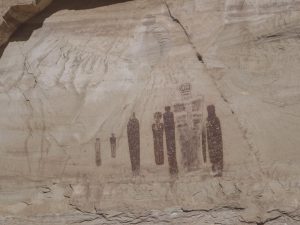
Horseshoe Canyon is an exceptionally beautiful canyon and it contains what many consider to be the best and most extensive collections of Barrier Canyon style pictographs. Most famous is the “Great Gallery” which includes the “Holy Ghost” figure.
We got back out on the pavement before the storm hit and drove to Fruita, UT, the headquarters for Capitol Reef National Park. We had formulated an ambitious itinerary that strung together multi day and single day hikes that we had done on previous trips. Plan A was to put all that together into an 8-9 day traverse of the park.
After sitting out a pretty soggy Monday and Tuesday, a bit of an un-settled break in the weather was forecast. Our route started outside of the park, climbed up thru some BLM land to a high ridge and then crossed into the park at a feature known locally as the “W”. There is a lot of cool petrified wood and some big views up there. The Park Service has a description available for this section called “Upper Spring Canyon”, but there is no trail and route finding is required.
We camped in a moderately exposed spot just below the “W” and got hit in the middle of the night by an intense electrical storm. Driving wind and rain with rapid fire lighting. Mostly 10 to 15 seconds from flash to thunder but some 5 sec flashes. So 2-3 miles away but some within a mile. Yes, I was nervous, Karen not so much.
The next day we cruised down Spring Canyon for 7-8 miles and camped just above the intersection of the Chimney Rock Trail. This put us in position for an early start of our 3rd attempt at summiting Capitol Point. On our first attempt a few years earlier we had spun around at the bottom for an hour or two trying to find the right way up. On our next try we got stalled in another spot along the way for a couple of hours. With shorter days in the spring and fall, the route finding delays kept us from getting it done. The third time was the charm! We made it up to the top and back to camp in about 7.5 hours.
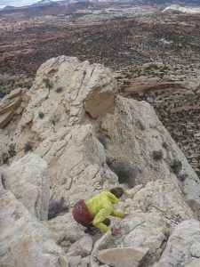
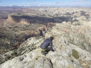
It’s a super cool route but complex. No trails, cairns or footprints. Pretty remote country. After convoluted route finding there is a final low class 4 scramble up loose talus to a small broken summit. Magnificent views and just a very cool spot. We were so psyched to be up there but 30 mph winds did not allow for a leisurely hang out. I had set a few waypoints in the start up gully system and at couple of key spots along the way. Very helpful on the way back, especially at the bottom. Descending back into Spring Canyon to the start up point is complicated. Not recommended if wet or in the dark!
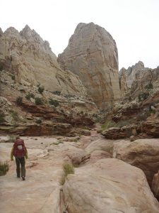
Day four we continued along the remainder of Spring Canyon to where it ends at the Freemont River and the highway into the park. That section of Spring Canyon is exceptionally beautiful and can be done as a day hike from Chimney Rock. Highly recommended.
At this point Plan A was to cross the highway in the morning and travel up thru the Grand Wash before exiting left and climbing up to Fern’s Nipple. The weather forecast was for 2 days of rain/snow mix so……, we eddied out in the van for the next two days. We were glad we did.
After 2 days of park campground and going into Torrey, the weather broke and we resumed our trek. The road into the Grand Wash trail head was closed due to the rain. Karen dropped me and the packs at the closure gate and shuttled the van to the end of the pavement on the park scenic drive.
The route that leaves the Grand Wash and heads up to Ferns Nipple is not a park service trail. It is marked with some cairns but it’s challenging to follow in places and crosses difficult terrain with cliffs and etc.
Fern’s Nipple is another named peak within the park. I had been on the top twice and Karen once before. A bit of sketchy 4th class climbing is required on the final pitch to the top. Many might want a belay, especially on the way down. Being up there is mighty fine. Tremendous 360 degree views of the park across the Waterpocket Fold and beyond, including Capitol Point sticking up in the far distance to the North.
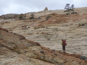
After descending back down from the top of Fern’s we started traveling South towards the Golden Throne. This was the one section of the route that we had not previously been on. I suspected it would be an adventure and it was decidedly more complex than the mental picture I had formed by studying the USGS 7.5 minute map beforehand. Nevertheless we had a good route marked on the map and we were able to navigate through pretty effectively.
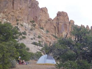
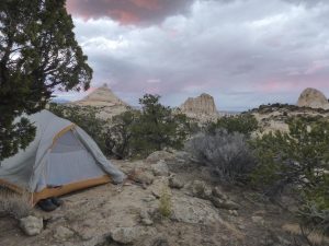
We spent that night not far from Fern’s Nipple in one of the most fantastic spots we have ever camped. Indescribable. We got lashed pretty hard by a rain storm late in the night but stayed dry inside the tent.
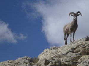
More route finding and navigating was required the next day as we worked our way across the distance to the Golden Throne. Lot’s of drainage’s and large prominent rock features surrounded by typical sand, scrub and cactus. We were a bit off to the left of a critical point on the route when we had an extraordinary encounter with a Desert Bighorn. This superb animal seemed very curious about us. We tried to skirt around it and not disturb it but the bighorn sort of followed us around for a bit and kept checking us out from above as we worked our way back to where we needed to be. Very cool.
We made it to the end of the park service Golden Throne trail by early afternoon. The trail starts up from Capitol Gorge and continues up through ledges and around bays for 2 miles to a very scenic spot beneath the Golden Throne. Because the road into the trail head below was closed, we had this normally very popular destination all to ourselves. After a nice picnic we proceeded down the trail and into Capitol Gorge. We camped that night a little way up in a side canyon we had visited once before.
The following day was one to remember. We continued South across the Waterpocket Fold through a section we had visited twice before but from a different direction and alternate routes. A gem among jewels. We camped for our final night down low along Pleasant Creek. A vigorous little rain storm hit just as we were getting ready to make dinner.
In the morning we had an enjoyable half day walk up Pleasant Creek and back to the van. Some good petroglyphs to check out along the way. After a little lunch and organizing we hit the road and van camped that night on Cedar Mesa. We arrived back home in the early afternoon to snow covered peaks and the last of the fall colors.
That’s the trip report and good on you if you read through the entire piece. I shot 430 photos along the way. Here is a link to a Slideshow of the best 25. Thanks for reading!


Congrats on yer Capitol summit!
Thank you Tracy. We were glad to finally get up there.
Good on me to the end. You and Karen have inspired me to explore Tonto National Forest and Phoenix area when I vacation at Xmas.
rock steady Jessica!