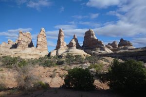
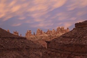
This Fall we enjoyed an exceptional 11 day backpacking trip through Canyonlands National Park. We had originally reserved our Park Service Backcountry Permits with a start date of October 11. A large storm bringing the seasons first big snowfall was forecast for that day so we moved our permit forward 2 days.
The storm was pretty significant and we were glad to have avoided it on our starting day. It had the benefit of filling up all the backcountry potholes and potentially providing more water sources for us.
The daily high and low temperatures were about 10 degrees cooler than average for that time of year – primarily clear sky’s with highs in the mid 60’s and lows in the low 30’s. There was significant morning dew on the second half of the trip, and some frost as well. The dew left the outer surfaces of sleeping bags, tent and packs fairly wet. Once the sun hit, things dried out quickly.
Our itinerary would follow the same general route we took in 2016, but with some interesting variations. We started in the Needles District, hiking down to the Colorado River on the first day. After crossing the river we did a nine day circle through the Maze District. We crossed back over the river and the final day was spent hiking back up through the Needles district to the van at the trailhead parking area.
My pack base weight (everything but food, water and stove fuel) was 24 lbs. Karen’s base weight was 21 lbs. After adding 11 days of food, 2 liters of water and 1 litre of tequila, I left the van with a pack weight of 49 lbs. Karen was at 40.
I carry about 3 lbs of electronic stuff. That includes a “garmin inreach mini” satellite communication device, an iphone (it pairs with the inreach and has a topo map app), a very small “garmin foretrex” gps, a battery pack to recharge that stuff if needed and a small digital camera with an extra battery. Add in a few maps, a compass and other minor navigation stuff. It seems like overkill but I would not feel comfortable without all of it. Especially on an 11 day trip through complex desert terrain, often not following established trails. I plan to compose a future blog post detailing why I bring it all and how I use it.
After getting a ride across the river from a friendly rafter, we spent a day hiking to a beautiful canyon with a known water source. We camped there for a second night and spent the next day hiking with day packs up to the head of the canyon. Super nice.
The next morning, we moved a short distance to an adjacent canyon. We had plenty of time for another extensive day hike and plenty of water availability for camping. Now we had used up 4 days of food, fuel and cactus juice and our packs are feeling a bit lighter.
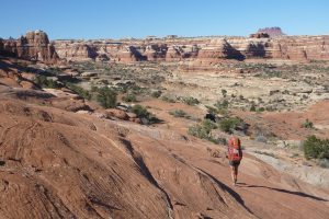
We then moved on and hiked into the Maze proper and descended down into the Maze via a route that we had not previously traveled. It was a great way to go, cruising along atop a slick rock ridge with stunning views into canyons on both sides.
That night we camped down in the canyon bottom of the Maze proper near the famous Harvest Scene pictograph panel. In the morning, after some study of the maps we decided to follow an adventurous route up and out of the Maze. There were 5 spots along the route that required some class 4 climbing and hauling of packs with a rope. We used a simple belay on 4 of those pitches. Exciting and doable for us but nearing our level of risk tolerance.
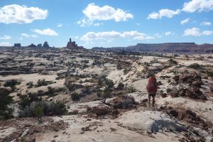
The payoff was topping out at the “Chocolate Drops”. From there we followed another wonderful ridge trail with fantastic views looking off one side into the “Petroglyph Fork” and the off the other side into the “South Fork” of the Maze. We ended up on the four wheel drive road in “The Land of the Standing Rocks”.
Following the road for about three miles, we dropped back down into the slick rock canyons and camped that night at an historic cowboy spring. The weather forecast for the day was 10% chance of showers. By the time we set up camp the updated forecast was 30% chance and clouds were building. Just after we got done eating dinner the storm hit with an initial 40 mph wind blast and hard rain. We rushed to set up the tent and got it tied down hard.
It rained all night with constant wind gusts into the 30 mph range. We were set up on a small rock platform, above the main canyon floor, just big enough for the tent. After an hour or so of driving rain it began to sound like we were camped next to a class 5 rapid. The water coming off the 40′ pour-over above the spring was insane. It rained hard for 6+ hours. Thankfully we were in a safe place, battened down tight and we stayed high and dry (although we did not get much sleep).
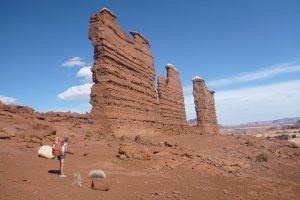
The next morning was bluebird clear and we moved on into the general area of the Fins. The previous nights rain had left a lot of good water in this normally very dry zone. That allowed us to spend two nights there where we enjoyed extensive day hiking and exploring.
After leaving the Fins, we were nearing the end of our trip. We spent a day hiking towards the Doll House and another night camped in a cool spot. The next morning we descended to the river. The plan was to camp nearby and cross in the morning. But, luck was with us again, once we got to the river a private river trip group offered to shuttle us across. A stiff hike back up through the Needles District to the van and voila… another sensational and successful trip comes to an end.
I shot 215 photos along the way. Click Here to see @ a dozen “best of” curated collection.


